
Quick Answer
Table of Contents
What Is a Robotic Total Station?
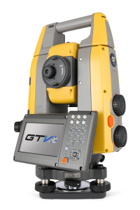
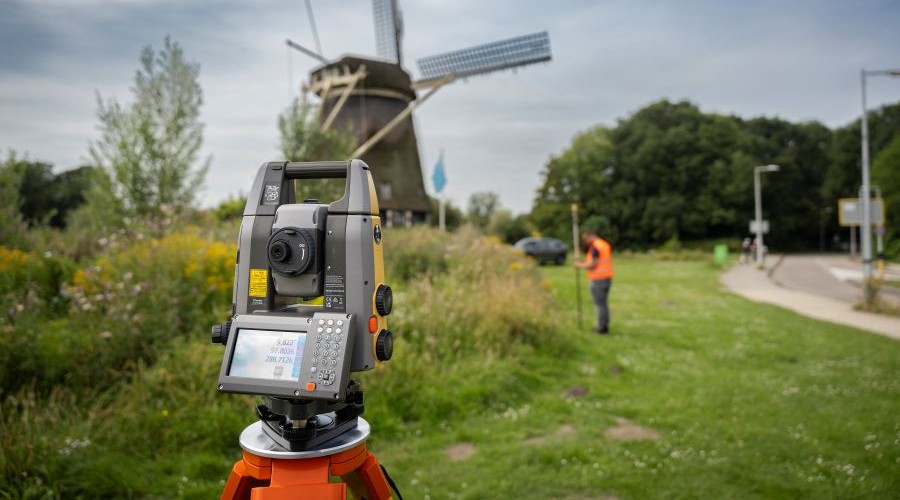
A total station is the core instrument of modern construction layout. It combines an electronic distance meter (EDM) with a precise angle-measuring system to determine the exact position of any point relative to where the instrument is set up. A robotic total station adds two things: motorized drives that turn the instrument automatically, and a radio or Bluetooth link to a handheld controller.
That combination removes the second person. On a conventional total station, one worker stands at the instrument and aims it while a second holds the prism. On a robotic total station, the instrument aims itself. It locks onto the prism and follows it, so the operator carries both the prism pole and the controller and works alone. The result is faster layout, lower labor cost per point, and the ability to put a crew member on layout without pulling a second person off other work
How Does a Robotic Total Station Work?
A robotic total station measures every point using the same three fundamentals, then automates the aiming and tracking around them:
- Angle measurement. High-resolution encoders read the horizontal and vertical angle of the telescope to a fraction of an arcsecond, establishing the precise direction to the target.
- Distance measurement. The EDM fires a laser at the prism (or, in reflectorless mode, directly at a surface) and measures the return to calculate distance, typically accurate to 1 to 2 mm plus 2 ppm.
- Position calculation. From one known setup point, angle and distance resolve into exact X, Y, and Z coordinates for the target, which the controller compares against the design file.
- Automated tracking. Motorized drives (brushless DC or ultrasonic, depending on the model) keep the instrument locked on the prism as the operator moves, so it stays aimed without anyone touching it.
- Wireless guidance. The controller loads the project file (DWG, DXF, PDF, or BIM model) and gives the operator live left/right and forward/back guidance to each point. When the operator hits the exact location, the screen confirms it and the point gets marked.
If the line of sight breaks, busy jobsites cause this constantly, the instrument re-acquires the prism automatically or with a single tap, often using a remote re-acquisition aid. The operator stays at the work, not back at the tripod
Robotic vs. Manual Total Station vs. 3D Layout Navigator
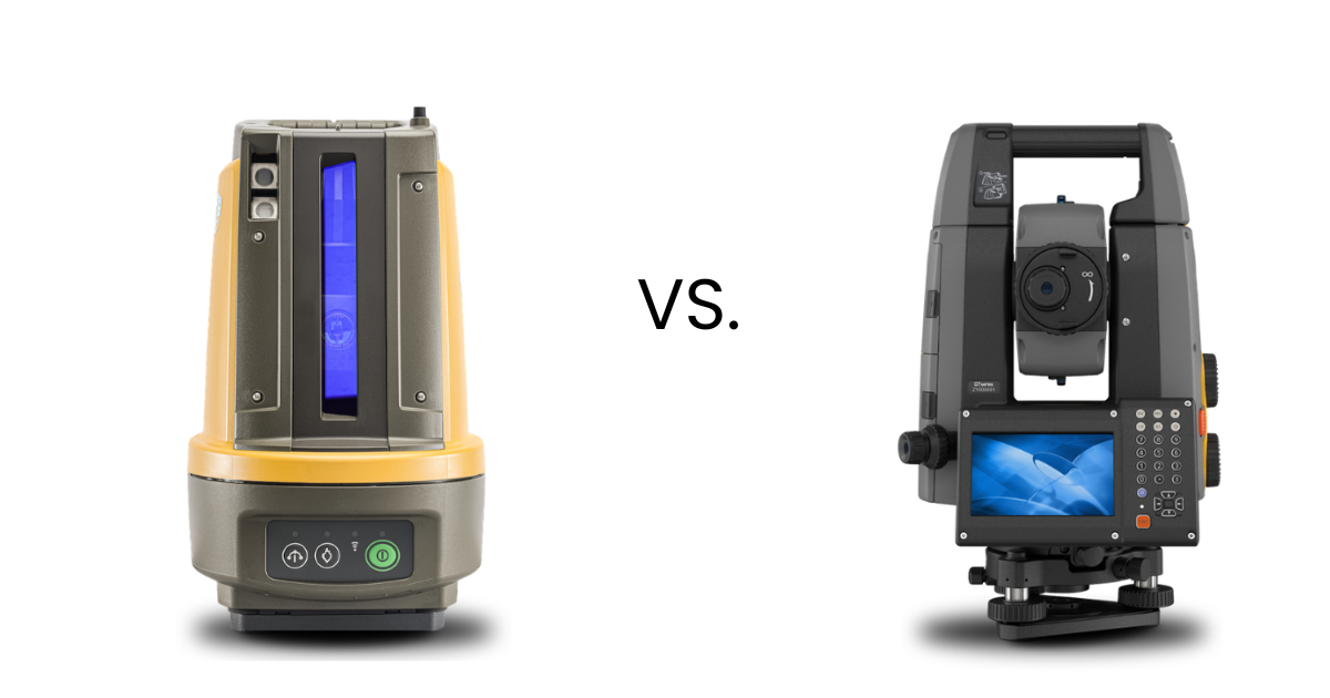
Three tools get grouped together but solve different problems. The right one depends on range, whether you need surveying capability, and how much setup complexity your crew wants.
| Manual Total Station | Robotic Total Station | 3D Layout Navigator | |
|---|---|---|---|
| Crew Size | Two people | One person | One person |
| Built For | Survey + construction layout | Survey + construction layout | Construction layout only |
| Setup | Manual leveling | Tribrach leveling | One-button self-leveling |
| Communication Range | Varies | Up to 1,984ft away (Topcon GT/GTV Series) | Up to 426ft away |
| Learning Curve | Very steep | Moderate | Minimal |
| Best Fit | IP65 Dust & Waterproof | Complex commercial work | Residential, Interiors, MEP |
A 3D layout navigator like the Topcon LN series strips out the surveying complexity and focuses purely on getting design points onto the floor fast, which makes it ideal for interior and MEP work. For longer-range layout, exterior site work, or full surveying, a robotic total station like the GT or GT-600V series is the right tool. Many contractors own both.
What Is a Robotic Total Station Used For?
On survey crews and construction sites, a robotic total station handles any task that starts with a coordinate and ends with a mark on the ground or a measurement for the record. Common applications include:
- Concrete and foundations: anchor bolt and embed layout, slab edges, footings, foundation walls, form lines
- MEP layout: hanger points, equipment pads, duct centerlines, pipe and sleeve penetrations
- Structural steel and masonry: column centerline verification, bearing wall layout, erection checks
- Interior systems: Metal stud wall framing, soffits, acoustical ceilings
- Fire protection: sprinkler head locations, branch line routing, standpipe centerlines
- Site and survey work: boundary and topographic surveys, grading and earthwork staking, as-built verification and QA/QC
Because the same instrument captures as-built positions, crews also use it to document what was actually built and feed that data back into the model for quality control.
How Accurate Is a Robotic Total Station?
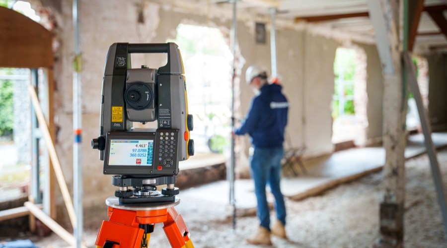
Accuracy is described two ways. Angular accuracy is measured in arcseconds and ranges from 1 to 5 seconds depending on the model. Distance accuracy is typically 1 to 2 mm plus 2 ppm. The angular number matters most for layout, because a small angle becomes a larger offset the farther you are from the instrument. The table below translates angular accuracy into the offset you would actually see on site, in inches.
| Distance from instrument | 1″ Class | 2″ Class | 3″ Class | 5″ Class |
|---|---|---|---|---|
| 50 ft | < 1/16″ | < 1/16″ | < 1/16″ | < 1/16″ |
| 100 ft | < 1/16″ | < 1/16″ | < 1/16″ | < 1/16″ |
| 200 ft | < 1/16″ | < 1/16″ | < 1/16″ | 1/16″ |
| 400 ft | < 1/16″ | < 1/16″ | 1/16″ | 1/8″ |
| 600 ft | < 1/16″ | 1/16″ | 1/8″ | 3/16″ |
| 1000 ft | 1/16″ | 1/8″ | 3/16″ | 5/16″ |
For most building construction layout, a 3 or 5 second instrument is more than enough. For high-order control, monitoring, or boundary work, a 1 or 2 second instrument earns its premium.
How to Choose a Robotic Total Station
The right model comes down to range, accuracy class, and whether you need full surveying or only construction layout. Topcon splits its robotic line into three families:
GT Series: the flagship survey-and-construction platform, with 1 to 5 second models, up to 5,000 m range, and hybrid GNSS capability. Best when you need both surveying and layout.
GT-600V Series: purpose-built for building construction layout, with high-speed ultrasonic motors, 3 or 5 second accuracy, and IP65 durability at a more accessible price.
LN Series 3D Layout Navigators: the simplest way into robotic layout, with one-button self-leveling and no survey background required. Ideal for interior, MEP, and small-mid sized concrete projects
Ready to see Robotic Layout in person?
Site Precision helps contractors and survey crews across the Midwest choose the right robotic total station and get their teams trained and productive. Every purchase includes on-site startup training, in-house service in Grand Rapids, and loaner units so your project never stops. Schedule a hands-on demo at your jobsite or our showroom.
Frequently Asked Questions
A standard total station requires two people: one at the instrument and one at the prism. A robotic total station has motorized drives and a wireless controller, so it tracks the prism automatically and one operator can run it alone from the prism pole.
Yes. Single-operator use is the main reason robotic total stations exist. The operator carries the prism pole and a wireless field controller, and the instrument aims and tracks itself. This typically cuts a two-person layout crew down to one.
Angular accuracy ranges from 1 to 5 arcseconds depending on the model, and distance accuracy is typically 1 to 2 mm plus 2 ppm. At common construction distances that translates to well under an eighth of an inch, tighter than tape-and-string methods can reliably hold.
It depends on the model. Construction-focused instruments can communicate with the tablet up to 1,984ft away.
Not for construction layout. Modern field software gives plain left/right and forward/back guidance to each point, and 3D layout navigators add one-button self-leveling. Most crews are productive within a few hours of training. Full surveying workflows take more experience.
Topcon instruments run field software such as Topcon Digital Layout and connect to office and cloud platforms like MAGNET. The software imports DWG, DXF, PDF, and BIM files so the points you lay out come straight from the coordinated design model. Don’t have a model? That’s fine, simply sketch your plan into the field software.
Final Verdict
A robotic total station turns a two-person survey and layout crew into a one-person operation without giving up accuracy. It measures angles and distances, tracks the prism automatically, and guides a single operator to every point in the design. For construction layout, surveying, and as-built verification, it is the fastest, most repeatable way to get points from the plan onto the site. The right model depends on your range, accuracy needs, and whether you need surveying or only layout, and that is a short conversation worth having before you buy.