
Topcon Mobile 3D Laser Scanners
The fastest, smartest way to bring high-accuracy mobile reality capture to your jobsite.
Choose Your Reality Capture Platform
Topcon’s reality capture portfolio responds to growing market demands for accessible, high-precision 3D scanning. Whether you need an ultra-lightweight smartphone-driven collector, a premium survey-grade handheld SLAM scanner, or a high-density mobile mapping network, select the perfect model for your workflows.
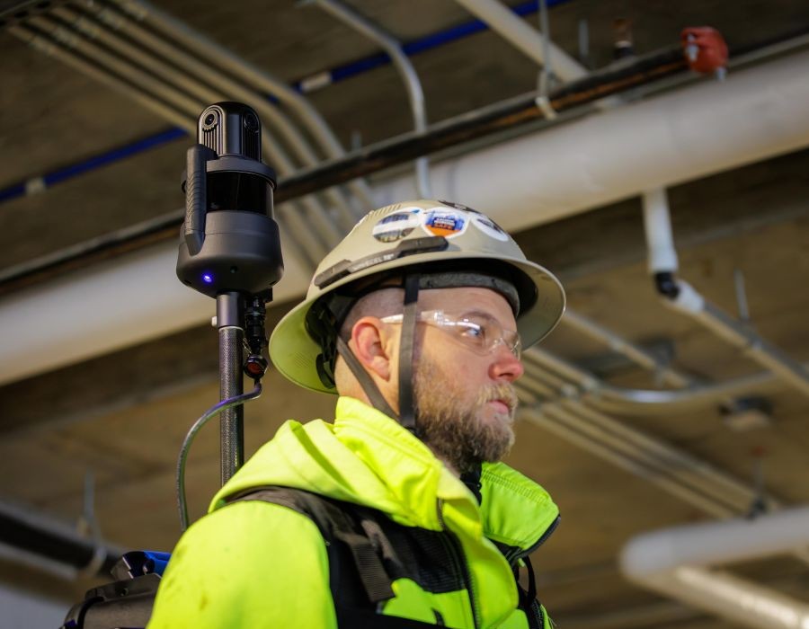
Topcon CR-M1
Mobile Mapping System
A versatile, high-speed mobile mapping system built for backpack, survey pole, or vehicle mounting across any terrain. It uses an advanced 32-channel laser sensor to execute continuous high-density point cloud capture while moving.
- Scan Rate: 640,000 points per second.
- Scanning Range: 0.05 to 120 m (0.16 to 394 ft).
- High Precision: Local accuracy of 4 mm; accuracy with control points down to 1 cm.
- Field of View: Full 360° x 360° coverage with integrated cameras for colorized detailing.
- Best For: Urban mapping, multi-floor building documentation, underground spaces, stockpiles, and forestry analysis.
Topcon CR-S1
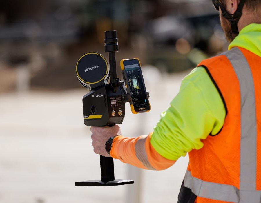
Portable SLAM 3D Scanner
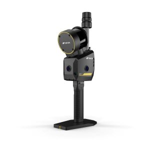
A premium, high-performance handheld 3D scanning system that offers increased point-cloud density, extended scanning range, and upgraded panoramic imaging. It combines advanced multi-sensor fusion (MLF-SLAM, VSLAM, and RTK-SLAM) to deliver survey-grade precision in any environment.
- Scan Rate: 320,000 points per second.
- Detection Range: Up to 120 m (393.70 ft) at 90% reflectivity.
- High Precision: LiDAR accuracy 0.5 cm; absolute accuracy <3 cm; relative accuracy <1 cm.
- Integrated Imaging: 3 x 12MP panoramic cameras and 2 x 1.3MP VSLAM cameras.
- Best For: Topographic mapping, large-scale site surveys, infrastructure assessment, tunnel/mining documentation, and GNSS-denied environments.
Topcon CR-S2
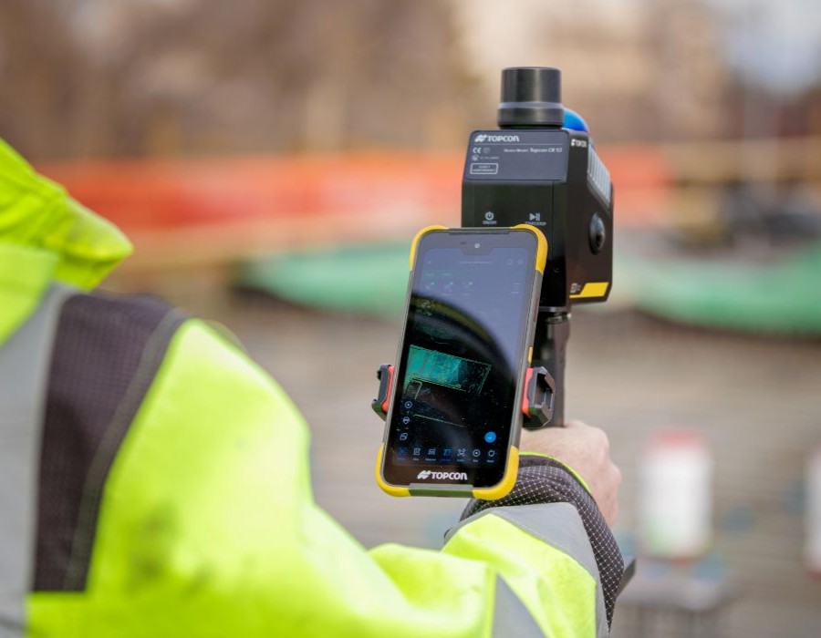
Portable SLAM 3D Scanner
A lightweight, versatile handheld 3D SLAM scanner designed for rapid on-the-move environmental coverage. It delivers real-time colorized point clouds and meshes while maintaining centimeter-level accuracy even indoors or under dense canopy.
- Scan Rate: Up to 200,000 points per second.
- Detection Range: Up to 70 m (230 ft) at 80–90% reflectivity.
- Precision Metrics: Relative accuracy <2 cm; absolute accuracy <3 cm; RTK horizontal 0.8 cm + 1 ppm.
- Integrated Imaging: 2 x 12MP panoramic cameras and 2 x 1.3MP VSLAM cameras.
- Best For: Tight spaces, progress monitoring, stockpile volume calculations, and indoor/outdoor construction site mapping.
Topcon CR-H1
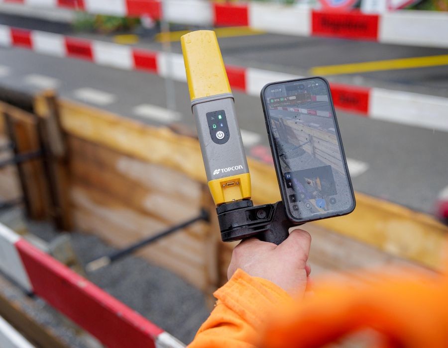
Handheld Capture Reality Solution
An ultra-portable, one-handed handheld reality capture solution that turns a standard iPhone Pro into a professional tool. It uses photogrammetry and PIX4Dcatch to deliver high-accuracy, full-color 3D point clouds and imagery while you walk.
- RTK Precision: Horizontal: 10 mm + 0.8 ppm / Vertical: 15 mm + 1 ppm.
- Camera Compatibility: 48 MP (iPhone 16 Pro & iPhone 16 Pro Max); iPhone 15 Pro or higher recommended.
- System Weight: Approximately 650 g (1.43 lbs).
- Software Ecosystem: PIX4Dcatch (mobile) and PIX4Dcloud (processing).
- Best For: Rapid site verification, stockpile measurement, subsurface/utility mapping, earthworks, and 3D documentation.
What Is a Mobile 3D Laser Scanner?
The Short Answer
A mobile 3D laser scanner is a reality capture instrument that collects millions of measurements on the move to create detailed three-dimensional models. Instead of using static tripod setups, operators can capture entire environments simply by walking or driving through a site, providing rapid documentation for large-scale construction and infrastructure projects.
How It Works
The instrument utilizes advanced sensor fusion—combining high-speed LiDAR, visual SLAM, an internal IMU, and GNSS positioning—to accurately map its surroundings while in motion. As the operator moves, the system captures up to 640,000 points per second across a complete 360° horizontal and vertical field of view to generate a dense, colorized point cloud. Integrated software like Collage Web allows teams to visualize, process, and share these mobile datasets directly via the cloud.
Why Mobile 3D Laser Scanners for Construction
Topcon mobile scanners accelerate reality capture by removing traditional positioning constraints. Software integration allows teams to quickly compare as-built conditions against BIM models, track progress, and safely map complex or GNSS-denied environments like tunnels and building interiors. This rapid data collection and cloud collaboration help teams make faster, more informed project decisions.
Key Capabilities
- ✓ Advanced sensor fusion combining LiDAR, SLAM, IMU, and GNSS
- ✓ Centimeter-level accuracy using Topnet Live RTK
- ✓ Rapid data capture while walking or moving
- ✓ Scanning speeds up to 640,000 points per second
- ✓ Complete 360° horizontal and vertical field of view
- ✓ High-resolution colorization via 4K and 8K cameras
- ✓ Lightweight, ergonomic design for field comfort
- ✓ Versatile pole, backpack, or vehicle mount setups
- ✓ Reliable tracking in indoor and GNSS-denied areas
- ✓ Cloud visualization and sharing via Collage Web
Technical Comparison
Both tools do layout. The right choice depends on your typical projects, working range, and whether you also need surveying capability.
Core Operational Advantages
True Mobile Data Collection. Forget stationary setups, multiple tripods, and time-intensive point registrations. Every instrument in this family captures high-fidelity 3D data continuously while the operator walks the site.
Advanced Sensor Fusion
Combines LiDAR, visual cameras, internal IMUs, and RTK data to hold precise coordinates even if traditional GNSS paths are blocked, obstructed, or unavailable.
Real-Time Visualization
Monitor your cloud coverage, track survey limits, and inspect processed colorization outputs instantaneously on the field controller or device screen.
Cloud-Connected Workflows
Publish field data straight from your app or device to Topcon Collage Web for instantaneous viewing, remote team collaboration, and seamless data sharing
Broad Third-Party Integration
Refine spatial assets easily and export files to universally recognized industry formats (such as LAS and e57) for clean use inside standard BIM, CAD, or GIS programs.
Training and Resources
Site Precision produces step-by-step video training for our portfolio of 3D scanners. Our library is growing every month, and every customer gets access from day one.
Trusted by Contractors Across the Midwest United States
Hear from professionals who have made the switch to robotic layout with Site Precision.
Mario and Brian are extremely knowledgeable about their products. Their customer service is the best of people I deal with. I won’t deal with anyone else when it comes to our laser/total station needs.
More Than Equipment. A Partnership.
When you purchase a robotic total station from Site Precision, you get expert support from day one and every day after.
When You Call, We Answer
Real humans pick up the phone. Our team is available during business hours to troubleshoot field issues, answer software questions, and help your crew stay productive.
In-House Service Department
Calibrations, repairs, and firmware updates handled right here in Grand Rapids. No shipping your instrument across the country and waiting weeks to get it back.
Loaner Units Available
If your instrument needs service, we provide loaner units so your project keeps moving. You should never have to stop work because your equipment is in the shop.
On-Site Training
Every purchase includes startup training at your location. We get your crew comfortable with setup, layout workflows, and software so they are productive from day one.
Remote Support
Need help in the field? Our team can connect remotely to walk through software questions, controller issues, or file management without waiting for a site visit.
Industry-Leading Warranty
Five-year motor warranty and three-year instrument warranty on all GT series models. Your investment is protected for years of demanding jobsite use.
See the Topcon Mobile Scanners in Action
Schedule a hands-on demo at your jobsite or our Grand Rapids showroom. We’ll show you how fast a single operator can map massive, complex environments simply by walking the site, completely eliminating time-consuming static tripod setups.
Topcon Mobile Scanner FAQs
What are Topcon mobile 3D laser scanners, and how do they work?
They use sensor fusion — high-speed LiDAR, visual SLAM (simultaneous localization and mapping), an internal IMU, and GNSS positioning — to build a 3D point cloud while you simply walk or drive through a site, instead of setting up on a stationary tripod like a traditional scanner.
Which mobile scanner models does Site Precision carry?
The CR-M1 (a mobile mapping system), the CR-S1 and CR-S2 (portable SLAM scanners with different range/weight trade-offs), and the CR-H1 (a handheld unit that pairs with an iPhone).
How do I know which mobile scanner is right for my project?
It comes down to site size and environment. Large sites, roadways, or multi-building corridors favor the CR-M1 or the CR-S1’s longer 394 ft range; tight interiors or fast walkthroughs suit the lighter CR-S2 (2.87 lbs) or the CR-H1, which runs on just an iPhone. Your Site Precision rep can help match the model to your typical project.
Do these scanners work in areas without GPS signal, like tunnels or parking garages?
Yes — the CR-S1, CR-S2, and CR-M1 use SLAM-based positioning (MLF-SLAM, VSLAM, and RTK-SLAM) rather than relying solely on GNSS, which is what makes them suited to GNSS-denied environments like tunnels, mines, and underground spaces.
How accurate are Topcon's mobile scanners?
It varies by model: about 1/8 in for the CR-M, roughly 3/8” relative accuracy for the CR-S1, about 3/4” relative accuracy for the CR-S2, and 3/8 in absolute accuracy via RTK for the CR-H1.
What's the difference between mobile scanning and traditional terrestrial/tripod scanning?
Mobile scanners capture data continuously as you move, eliminating the multiple tripod setups and point-cloud registration steps static scanning requires. Terrestrial scanners generally hold a slight accuracy edge from a single fixed viewpoint, so the trade-off is speed and coverage versus maximum single-point precision.
What does a mobile scan actually produce?
A dense, colorized 3D point cloud of the site, viewable in real time on the field controller during capture, and exportable in standard formats like LAS and e57 for your CAD, BIM, or GIS software. The point cloud can then be used to create deliverables such as 2D floor plans, 3D BIM models, surface meshes, topographic maps, immersive 360° walkthroughs, and more.
What software works with the mobile scanner data?
Field capture runs through MAGNET Flow (CR-S1/CR-S2), Onami Field Software (CR-M1), or PIX4Dcatch (CR-H1), and all of it can be published to Topcon Collage Web for cloud-based team collaboration and viewing. Raw point cloud data is compatible with the majority of CAD and BIM softwares.
Can I use a mobile scanner for stockpile or volume measurements?
Yes — stockpile and volume calculations are a stated use case for both the CR-S2 and CR-H1, alongside their broader mapping and documentation roles.
How much does a Topcon mobile scanner cost?
Pricing depends on the model and how it’s configured for your workflow, so we don’t publish a flat number. Reach out and we’ll walk through your project type and put together a quote.
Does Site Precision provide training on these scanners?
Yes, every purchase comes with on-site training from our experts, plus direct support from our team as your local Topcon dealer.
Can I demo a mobile scanner before buying?
Contact your Site Precision rep, we’re happy to run a live demo on your site or at our Grand Rapids facility so you can see the workflow firsthand before deciding.